Route
Highlights
- 311 miles, 500 kilometers
- Flat, less than 7000ft total elevation gain
- 80% trail (70% paved, 10% crushed limestone)
Overview
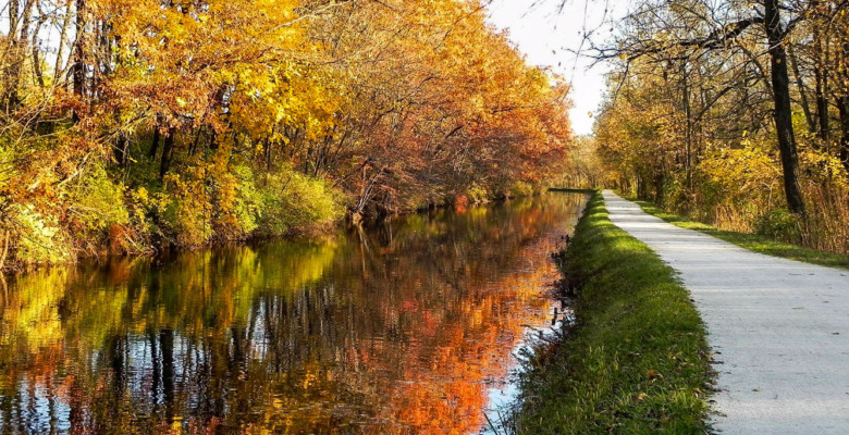
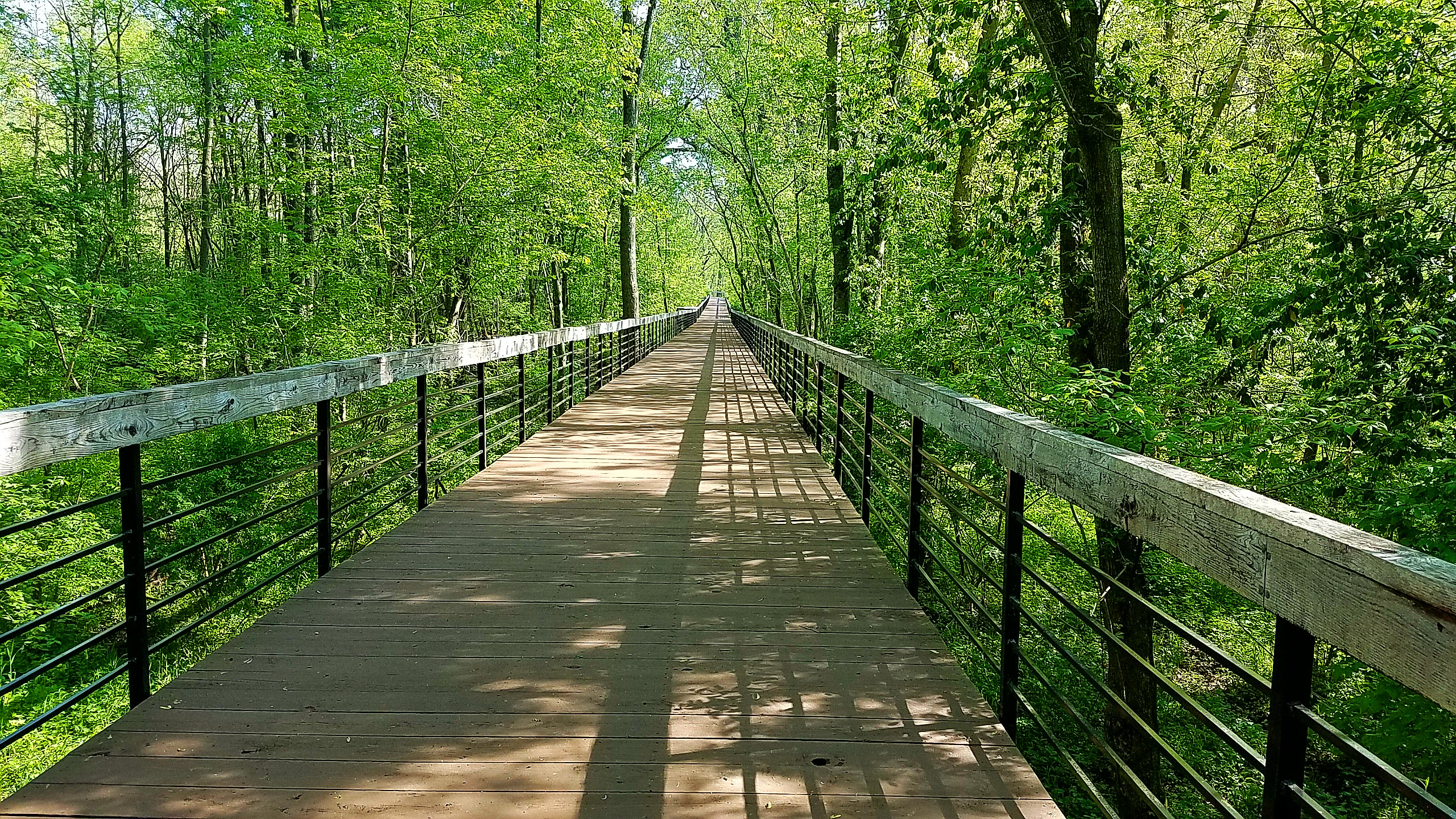
The route begins on the banks of the Ohio River in downtown Cincinnati at the riverfront park. The route from Cincinnati to Columbus is straight, paved, and fast. Yellow Springs, a friendly cycling town and home of Dave Chappell, is a short jog away as you pass through Xenia. You reach Columbus by late afternoon and should have time to resupply and prepare your bike to ride into the night. By the time you leave the Columbus metropolitan area the sun is setting and you are heading into the remote countryside of the Amish community. The gently rolling hills are illuminated by a full moon and the country roads are quiet. Things get busier as you approach Akron as you roll past Lebron James' high school grounds. As the sun starts to rise you quickly leave the city behind and enter the Cuyahoga Valley National Park. This path is mostly crushed limestone which offers a slower and winding route through Ohio's only National Park. When you exit the Park you are plunged back into the city at the edge of Cleveland. At this point you can taste the finish. Grab an early morning coffee and head to Edgewater Park on the shores of Lake Erie, the shallowest of all the Great Lakes. Celebrate your accomplishment by taking a plunge and don't forget to save your GPS activity for submission.
Details
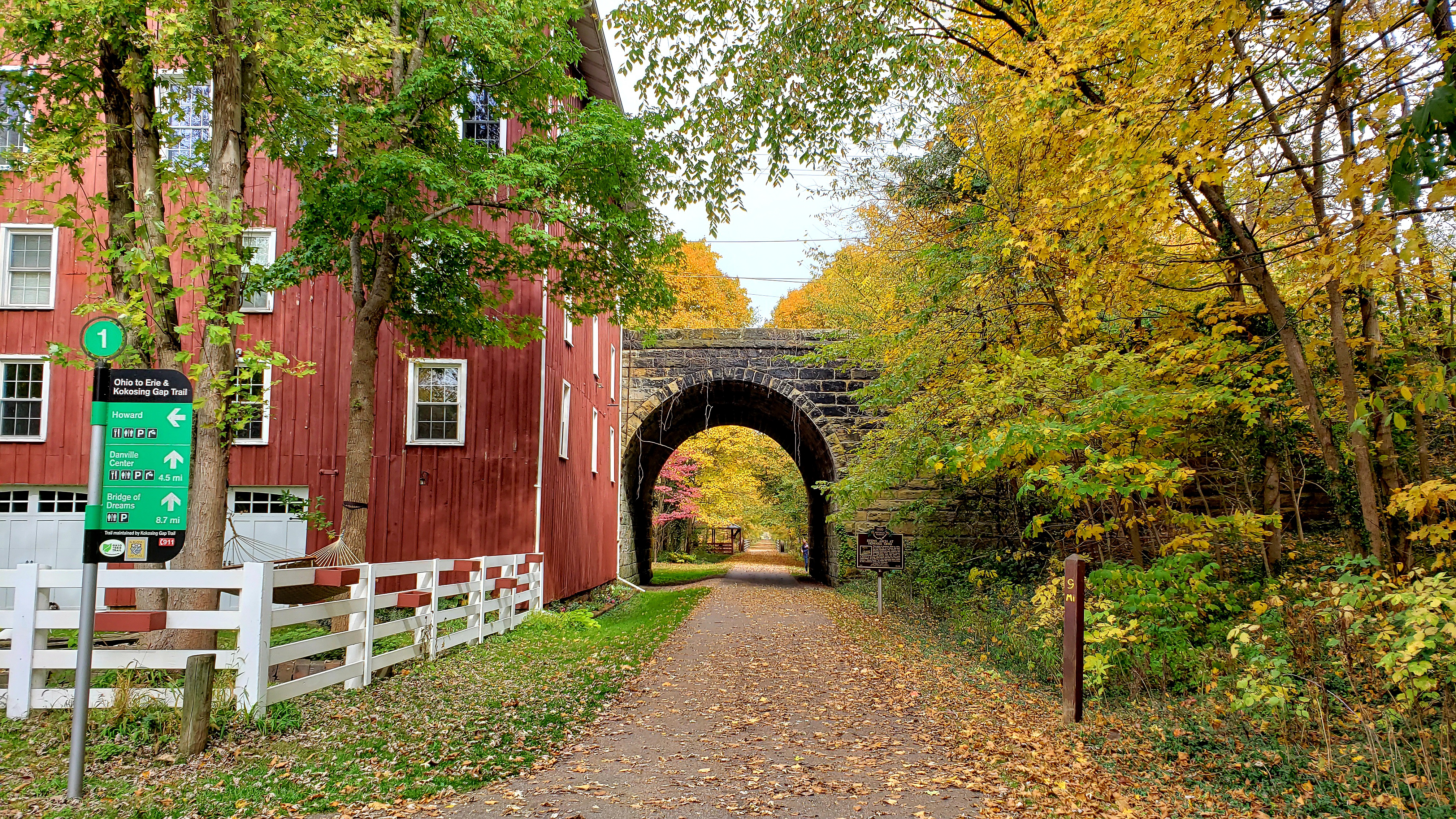
The Ohio24 route uses the Ohio to Erie Trail with a few notable differences. The Ohio to Erie Trail, also known as OTET, Ohio Bicycle Route 1, and soon US Bicycle Route 21, is a "326" mile route from Cincinnati to Cleveland. 10% of the route is still on roads, however these segments are being actively being replaced with off-road trail. As the OTET evolves so will the Ohio24 route. Currently, Ohio24 does not make use of the Massillon section of the OTET trail. There are also suggested route deviations through Columbus.
Prevailing winds are from the south. The route traverses Ohio from Southwest to the Northeast for this reason. While winds can be quite strong, most of the route has some tree cover that acts as a barrier if winds are coming from the north or east. While extreme weather is not common, Ohio does occasionally see 100+ degree Fahrenheit temperatures, severe lightning storms, hail, and tornadoes.
The RWGPS route below is provided for reference. Ohio24 does not require riders to follow the route exactly. Similar to randonneuring, Ohio24 makes use of control points that riders must pass through. These control points will be located in Cincinnati, Columbus, Akron, and Cleveland. This allows for route flexibility when trail conditions or construction prevent safe passage. However, there is a strict requirement for the route taken to be at least 311 miles or 500 kilometers long as determined by GNSS (GPS) activity files.
Until I can figure out how to embed an iFrame here is the link to the route.